Izra (Izra‘)
Izraʾ (إِزْرَع Izra') is a town in the Daraa Governorate of Syria, to the north of the city of Daraa. It is the administrative centre of the Izra' District, and sits at an altitude of 599 metres. Izra' had a population of 19,158 in 2004, according to the Syria Central Bureau of Statistics (CBS).
Izraa (Zorava, Zorowa or Zorabene) was a Canaanite city mentioned in the Bible. Located 80 km south of Damascus in the northern section of the Province of Daraa, its name appears in the Tell Amarna letters, documents which were exchanged between the Egyptian and Syrian rulers in 1334 B.C. Ancient inscriptions left by the Romans after their occupation of the Bashan area evidence the importance of the town.
An inscription found by the archaeologist Richter shows that the city was elevated to the rank of metrocomia (Great city) under the Emperor Severus Alexander (222-235 A.D.) and was known as Zorava.
Lejah (Trachonides or "the Rocky Land") forms a triangle with Borac as the northern apex, Izraa in the south-western corner and Shahba in the south-eastern corner. In the course of history, this region was a natural fortress that invaders found very difficult to conquer. Herod's soldiers failed to occupy it. Even the Crusaders under Baldwin III could not subdue it, because of its difficult terrain, the lack of water and the resistance of its people.
The Christian Gospel reached this region early because of its proximity to the Holy Land. It became an episcopal seat during the Byzantine era, and ranked second after the metropolitan see of Bosra throughout the whole of the Province of Arabia.
In 1253 An-Nasir Yusuf ordered the roofing of the Friday mosque in Izra.
The historian Ismail Abulfida described in his book Taqwim al Buldan that it was “to be one of the major capitals of Hauran, 18 miles from the region of Sanameine”.
Map - Izra (Izra‘)
Map
Country - Syria
 |
 |
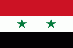
| Flag of Syria | |
The name "Syria" historically referred to a wider region, broadly synonymous with the Levant, and known in Arabic as al-Sham. The modern state encompasses the sites of several ancient kingdoms and empires, including the Eblan civilization of the 3rd millennium BC. Aleppo and the capital city Damascus are among the oldest continuously inhabited cities in the world. In the Islamic era, Damascus was the seat of the Umayyad Caliphate and a provincial capital of the Mamluk Sultanate in Egypt. The modern Syrian state was established in the mid-20th century after centuries of Ottoman rule. After a period as a French mandate (1923–1946), the newly-created state represented the largest Arab state to emerge from the formerly Ottoman-ruled Syrian provinces. It gained de jure independence as a democratic parliamentary republic on 24 October 1945 when the Republic of Syria became a founding member of the United Nations, an act which legally ended the former French mandate (although French troops did not leave the country until April 1946).
Currency / Language
| ISO | Currency | Symbol | Significant figures |
|---|---|---|---|
| SYP | Syrian pound | £ or لس | 2 |
| ISO | Language |
|---|---|
| AR | Arabic language |
| HY | Armenian language |
| EN | English language |
| FR | French language |
| KU | Kurdish language |


